
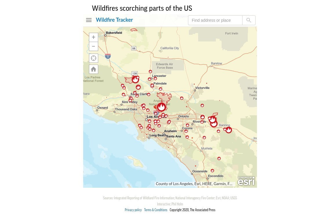
This fully interactive digital map shows wildfire activity and thermal detected hot spots across the U.S. and around the world. This map will update daily. Source: Integrated Reporting of Wildland-Fire Information; National Interagency Fire Center; Esri; NOAA; USGS.
Related Posts
 Patio of the Week: Planted Terraces Remake a Sloped Yard (17 photos)
 A Used Pop-Up Camper, a Tight Budget and Chic Scandinavian Style (8 photos)
 Houzz Tour: New Texas Country House With Timeless Touches (30 photos)
 Kitchen of the Week: Dark Green Cabinets and Family Function (14 photos)
 USC win over Cal reminds what Air Raid is supposed to look like
 12 Ways to Make the Most of Your Yard (14 photos)